
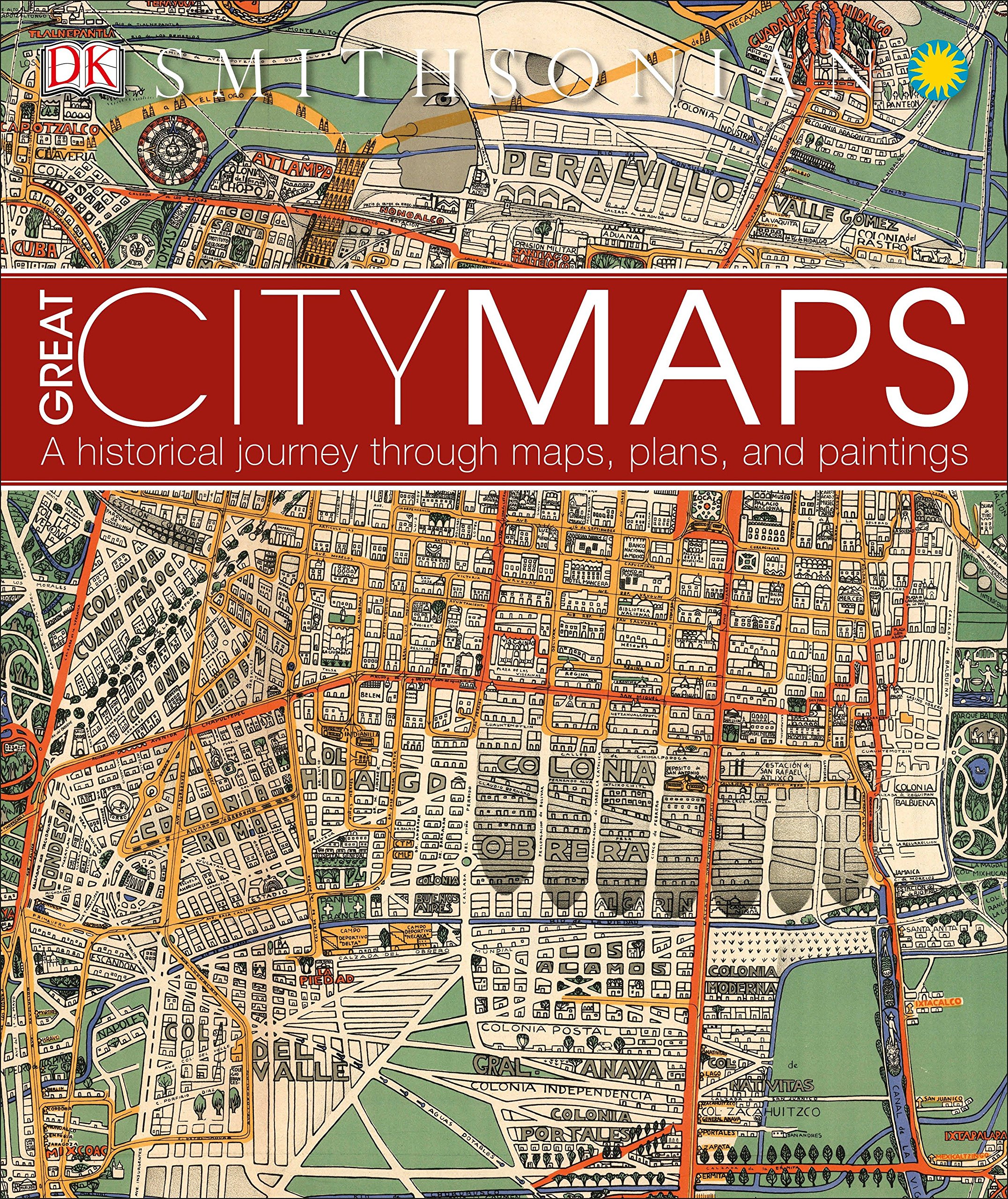
Great City Maps: A Historical Journey Through Maps, Plans, and Paintings (DK Great)
$27.96
Price: $27.96
(as of Mar 22,2022 09:50:09 UTC – Details)

From the Publisher

Jerusalem Floor Mosaic
“The mosaic has loosened … by change of temperature, by influence of moisture … and by sinking of the soil, to such an extent that it reacts even upon pressure by hand.”


Medieval Trading Centers
Trade played by no means a minor part in the ancient world, with amber, spice, incense, and silk routes evolving in the the first millennium BCE. These gradually developed into an intricate network, binding together disparate transcontinental regions via increasingly wealthy urban trading cities across the world.
The Wonderground Map of London Town
Commissioned shortly before the outbreak of World War I by Frank Pick, the commercial director of the Underground Electric Railway Company (now London Underground), and displayed in Tube stations across the metropolis, this is an eye-catching, charming, and comical poster map of London and its attractions.
Map of Cape Town
Late 19th-century Cape Town was a city in rapid transition, enjoying a sudden economic boom after the discovery of diamond fields to the north of it. In this 1884 map of the capital of the British Cape Colony—which is usually oriented with southwest at the top—the grid plan of the original Dutch settlement is still clearly visible.

Constantinople Tinted Engraving
“These [mosques] with the towers, ports, palaces … together with the myriads of small domes … press an appearance so Oriental … as to defy description.”


Paris, 1878
The man who revolutionized Paris, Georges-Eugène Haussmann (1809-91), was himself a native Parisian. However, he was not sentimental and even demolished the house he was born in because it stood in the way of progress (it made way for what was to become Boulevard Haussmann).
Rio de Janerio Print on Cloth
This map, oriented with west at the top, depicts Rio in a period of rapid expansion. The more or less regular north-south grid plan of the original settlement can be clearly seen, as can the ring of forts, strategically placed on the hills—morros in Portuguese—overlooking the city center.
New Amsterdam, 1660
The man who drafted the original Castello Plan arrived in the New World in 1652 as a tutor. Five years later he was appointed surveyor-general of the province of New Netherland, of which New Amsterdam was part. He lived on Long Island but kept this small office (top left), where it is likely that his maps was prepared.

Paris Hand-Colored Print on Linen
“Most of the streets of this wonderful Paris are nothing but intestines, filthy and permanently wet with pestilential water.”
Publisher : DK; Illustrated edition (September 6, 2016)
Language : English
Hardcover : 256 pages
ISBN-10 : 146545358X
ISBN-13 : 978-1465453587
Item Weight : 3.62 pounds
Dimensions : 10.31 x 0.86 x 11.19 inches
Related Products


$27.96
